BTO create and publish a variety of important articles, papers, journals and other publications, independently and with our partners, for organisations, government and the private sector. Some of our publications (books, guides and atlases) are also available to buy in our online shop.
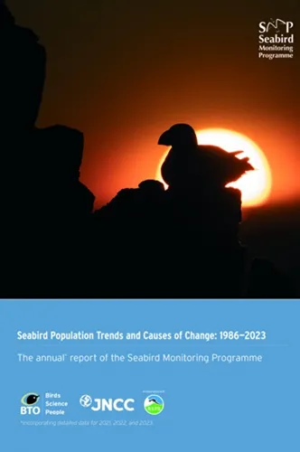
Annual report of the Seabird Monitoring Programme
Seabird Population Trends and Causes of Change: 1986–2023
This report presents the latest seabird population trends in breeding abundance and productivity using data from the Seabird Monitoring Programme (SMP).
The report documents changes in the abundance and productivity of breeding seabird species in Britain and Ireland from 1986 to 2023, and provides a detailed account of the 2021, 2022 and 2023 breeding seasons.

Search settings
How high do birds fly? Development of methods and analysis of digital aerial data of seabird flight heights
Author: Alison Johnston & Aonghais, S.C.P. Cook
Published: 2016
The purpose of this work was to develop a method for analysing digital aerial ornithology survey data, to derive species-specific flight heights. The focus of this work has been to develop an approach to analysis, rather than analysing a comprehensive dataset to derive generic flight height values. Although the project has been successful in developing such an approach to analysis, the BTO and Steering Group for the work emphasises that the values presented in this report are not intended to be used to inform assessments.Any party undertaking an ornithological collision risk assessment should seek advice from the relevant regulators and statutory nature conservation bodies on appropriate flight height values and avoidance rates to use. This report does not constitute such statutory advice.
16.03.16
Reports
Patterns and causes of covariation in bird and butterfly community structure
Author: Eglington, S.M., Brereton, T.M., Tayleur, C.M., Noble, D., Risely, K., Roy, D.B. & Pearce-Higgins, J.W.
Published: 2016
Non-uniform monitoringBTO is fortunate to hold unique large, long-term datasets on bird abundance and distribution collected by dedicated volunteers. Our scientists translate these data into trends describing populations, which can be used in turn by policymakers and land managers for decision-making. Not all taxa are so well understood, as for many species, little information is collected. One way of accounting for this is using a so-called 'surrogacy approach', where patterns of variation in less-well monitored species are assumed to be similar to those in better monitored species. Recent BTO research has set out to test this assumption, asking whether the population trends of highly mobile vertebrates, like birds, really be used to infer those of much smaller invertebrates, like butterflies.Cross-taxa variation at a fine scaleMembers of the BTO’s Monitoring and Population Ecology and Modelling Teams worked with Butterfly Conservation and the Centre for Ecology and Hydrology to analyse data collected by volunteers taking part in the UK’s BTO/RSPB/JNCC Breeding Bird Survey (BBS). Since 2009, BBS volunteers have also been asked to survey butterflies on their randomly-generated BBS squares, as part of the Wider Countryside Butterfly Survey (WCBS). This provides a contrast between these small, specialised insects and birds. The size of BBS squares (1 km2) is critical to this work, as the fine spatial resolution allowed the study’s authors to assess patterns in a way that has not been possible in previous studies of cross-taxa relationships.Data were analysed to examine spatial variation in bird and butterfly distribution and community structure over a range of habitats and latitudes. Specifically, the researchers considered the total number of species recorded in each visit to the square (species richness), the diversity of these species and their “evenness”, which is a measure of how the abundance of species within a community differs (evenness is lowest when a community is dominated by a few, highly abundant species). Calculations were also made to assess the degree to which communities were composed of generalist or specialist species (the 'community specialisation index', CSI).Support for surrogacyThis study found significant similarities in the way UK birds and butterflies varied in species richness and diversity. These relationships remained when latitude and habitat-type was included in the analysis, showing that they were not simply a result of the common effects of temperature and land-cover on both groups. Instead they are likely to have resulted from common responses to variation in habitat-type, such as vegetation structure and heterogeneity within habitat-types. However, associations with evenness and CSI were much weaker, suggesting that the most specialised bird and butterfly species did not associate at relatively fine spatial scales. Specialist butterflies tended to occur in semi-natural habitats, whilst the most specialised bird communities were found in non-fragmented landscapes. Our results suggest that surrogacy approaches may be used where management decisions are based upon species richness and diversity. However, if conservation decisions prioritise particular rare and specialised species, then they will only benefit other taxa if those taxa also have similar responses to environmental change and management.
03.03.16
Papers

Earth Observation Data Integration Pilot Project 5 - Developing community and crowd-sourced validation of 'Living Maps'
Author: Stuart E. Newson, David J. Turvey, Samuel Neal, Simon Gillings
Published: 2016
Earth Observation data offer great potential for a range of terrestrial surveillance and management issues. Living Maps – land cover maps with a focus on priority semi-natural habitats – are being developed using state of the art data and remote sensing analyses. This report scopes out how volunteers could be engaged in the validation of the Norfolk Living Map, and how transferable proposed the techniques are to other regions of the UK.
01.03.16
Reports
An experimental evaluation of the effects of geolocator design and attachment method on between-year survival on whinchats Saxicola rubetra
Author: Blackburn, E., Burgess, M., Freeman, B., Risely, A., Izang, A., Ivande, S., Hewson, C. & Cresswell, W.
Published: 2016
24.02.16
Papers
The role of habitat change in driving Black Grouse Tetrao tetrix population declines across Scotland
Author: Pearce-Higgins, J.W., Wright, L.J., Grant, M.C. & Douglas, D.J.T.
Published: 2016
17.02.16
Papers Bird Study