BTO publishes various reports, from those covering the annual results of core surveys, through scientific studies, and on to those produced in partnership with other organisations. Many of these are published as BTO Research Reports. You can access all of our reports from here, though note that we are currently updating the reports section, working backwards through time to bring all of the report pages into a consistent format. You can read our Annual Report and Accounts in the Governance section.
Search settings
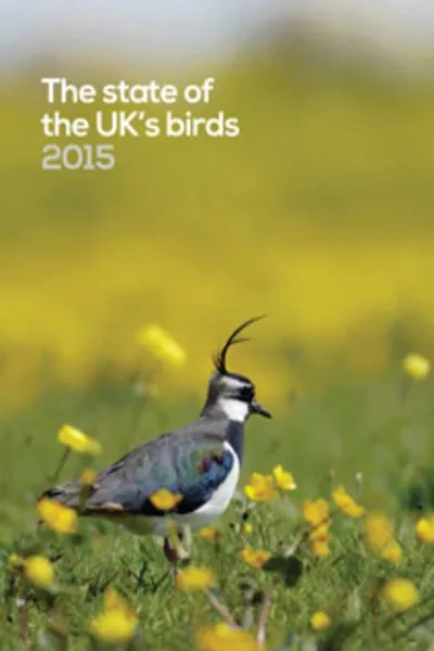
The State of the UK's Birds 2015
Author: Hayhow D.B., Bond A.L., Eaton M.A., Grice P.V., Hall C., Hall J., Harris S.J., Hearn R.D., Holt C.A., Noble D.G., Stroud D.A. and Wotton S.
Published: 2016
The two main themes of The State of the UK’s Birds report (SUKB) 2015 are farmland birds (illustrated by this year’s cover of a Lapwing) - a group that as a whole continues to decline, and how strong partnerships can help to reverse the fortunes of some of our farmland specialists - such as the Yellowhammer, currently faring well in Scotland; and species such as Tree Sparrow and Lapwing, all of which have shown evidence of positive responses on farms under Environmental Stewardship.
11.04.16
Reports State of the UK's Birds
An assessment of the potential benefits of additional stratification of BBS squares by habitat and accessibility to enhance the monitoring of rare species and habitats.
Author: B Martay, J W Pearce-Higgins, S Gillings & S R Baillie
Published: 2016
23.03.16
Reports
How high do birds fly? A review of current datasets and an appraisal of current methodologies for collecting flight height data: Literature review
Author: Chris B. Thaxter, Viola H. Ross-Smith & Aonghais S C P Cook
Published: 2016
The consideration of flight heights is a key factor determining how seabirds interact with offshore wind farms. Of particular interest is the need to accurately predict flight heights, in order to feed into predictive Collision Risk Models (CRM). Data within CRM have traditionally relied quite heavily on boat surveys collected by observers, but now routinely, different methods are being used to estimate flight heights of birds.To date, the relative suitability of methods for the collection of flight heights has not been rigorously appraised. For marine birds, this has primarily included visual methods from boat-based surveys, but more recently remote monitoring techniques such as high definition aerial imagery (images, video and spectrographic techniques) have been used. Alternative methods have also included bird-borne telemetry, radar, laser rangefinders, thermal imagery and acoustic methods, but their suitability to obtain reliable flight height distributions for potential use within CRM has not yet been assessed. This report details and compares each method for estimating flight heights, evaluating the relative merits and disadvantages of each method.
16.03.16
Reports
How high do birds fly? Development of methods and analysis of digital aerial data of seabird flight heights
Author: Alison Johnston & Aonghais, S.C.P. Cook
Published: 2016
The purpose of this work was to develop a method for analysing digital aerial ornithology survey data, to derive species-specific flight heights. The focus of this work has been to develop an approach to analysis, rather than analysing a comprehensive dataset to derive generic flight height values. Although the project has been successful in developing such an approach to analysis, the BTO and Steering Group for the work emphasises that the values presented in this report are not intended to be used to inform assessments.Any party undertaking an ornithological collision risk assessment should seek advice from the relevant regulators and statutory nature conservation bodies on appropriate flight height values and avoidance rates to use. This report does not constitute such statutory advice.
16.03.16
Reports
Earth Observation Data Integration Pilot Project 5 - Developing community and crowd-sourced validation of 'Living Maps'
Author: Stuart E. Newson, David J. Turvey, Samuel Neal, Simon Gillings
Published: 2016
Earth Observation data offer great potential for a range of terrestrial surveillance and management issues. Living Maps – land cover maps with a focus on priority semi-natural habitats – are being developed using state of the art data and remote sensing analyses. This report scopes out how volunteers could be engaged in the validation of the Norfolk Living Map, and how transferable proposed the techniques are to other regions of the UK.
01.03.16
Reports